
| |
|
WEEK 44 2005
Last Week- Sun- Mon- Tue- Wed- Thur- Fri- Sat- Next Week
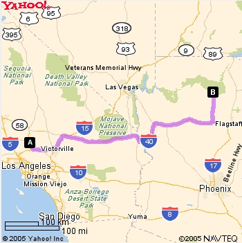
| Lancaster
Weather NOAA |
Lancaster WeatherUnderground |
| First Post, 17 March 2002 |
Three Years Ago, This Week, 2002 | Two Years Ago, this week, 2003 | A Year Ago, This Week, 2004 |
| Weekly
Picture Archive |